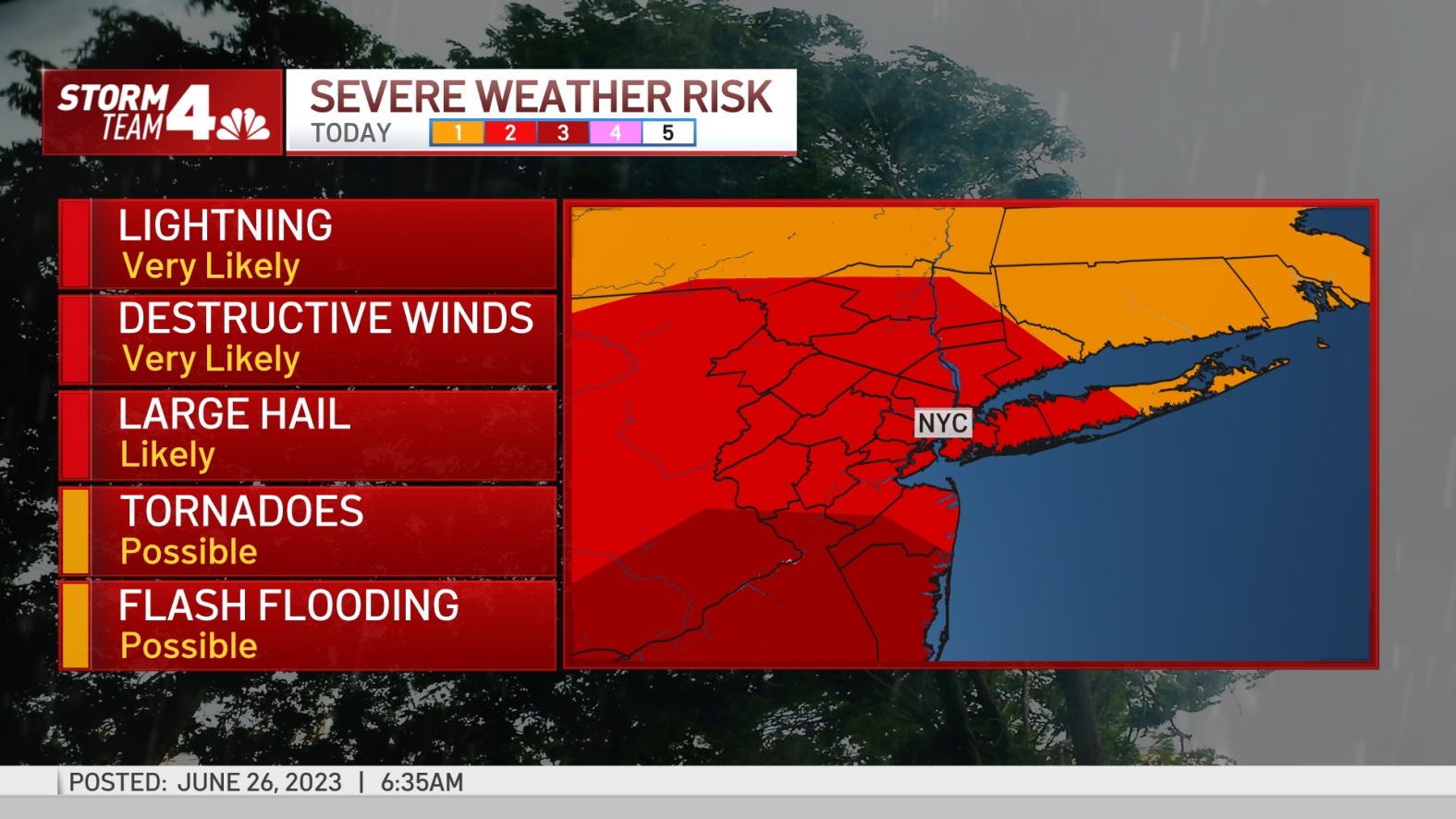
The system advancing from the Great Lakes and Midwest on Sunday could slip into the Mid-Atlantic and Northeast on Monday afternoon, posing a severe storm hazard across the tristate region.

Sporadic showers and a storm are expected Monday morning, but a severe thunderstorm is not expected until the afternoon. It will start around 4pm.
Severe winds in excess of 90 mph and lightning strikes are the biggest threats, but hail and flash floods are also possible in the area. Isolated tornadoes are also possible, especially in southern New Jersey.
This storm poses a threat to the entire Tri-State region, but will likely affect western and southern New Jersey. New York City, the Hudson Valley, and southwestern Connecticut could also be affected by the storm. That’s unlikely on Eastern Long Island.
However, no matter where you live in the area, this Monday will be warm and muggy, with temperatures in the 80 degrees.
The storm won’t stop until Monday and will continue for the next few days. It will pick up momentum again on Tuesday afternoon.


